
Because Environmental Sciences, Policy and Management (ESPM) student Louisa Brody graduates this spring, she’s been applying for full-time work while wrapping up her studies. Through the process, she’s noticed that jobs in the conservation and natural resources field consistently list geographic information systems (GIS) experience as a required qualification.
GIS isn’t everyone’s cup of tea – but it is an essential skill for people working in conservation. Feeling intimidated? Don't be! In this Q&A, Brody shares about her experiences learning GIS at the University of Minnesota and tips for students starting their first GIS course.
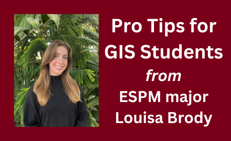
Name: Louisa Brody
Graduation year: Spring 2024
Major: Environmental Sciences, Policy and Management (ESPM) with a focus on conservation
Minor: Spanish
GIS Courses taken:
- FNRM 3131: GIS for Natural Resources
- ESPM 3031: Applied Global Positioning Systems (GPS) for GIS
- FNRM 3262: Remote Sensing and Geospatial Analysis of Natural Resources and Environment
What are your career goals?
I want to work in the field of conservation, focusing particularly on enhancing biodiversity of native plant communities. I am passionate about utilizing natural climate solutions and community engagement to combat the issues facing our environment and its inhabitants.
How does GIS fit into them?
GIS is a valuable decision-making tool for conservation strategies. It allows conservationists to analyze spatial data to understand landscape patterns, climatic trends, and relationships within ecosystems. This data can identify a variety of traits within an ecosystem such as the level of biodiversity, habitat connectivity, or vulnerability to threats such as invasive species or climate change. GIS is also an important tool in evaluating the effectiveness of conservation strategies once they have been implemented. Beyond that, it enables the integration of various data sources. For example, high-resolution visual data from satellites can be combined with on-the-ground field observations. This interdisciplinary approach allows for collaboration between stakeholders, such as government agencies, NGOs, and local communities.
Due to these assets, GIS is essential for my career aspirations; I consistently see it listed as a necessary skill on job postings.
What has your experience learning GIS at UMN been like?
GIS has a steep learning curve. It can be frustrating grappling with the intricacies of GIS tools and techniques, especially when troubleshooting errors or attempting to execute complex spatial analyses. However, despite the initial hurdles, the process of learning GIS has been incredibly rewarding. The longer I have studied GIS, the more positive my experience has become. It also helps that the professors within the ESPM and FNRM departments who teach these courses are incredibly responsive and supportive.
What do you like about GIS?
My favorite thing about GIS work is the sense of accomplishment that comes with tangible results. Many of my classmates have also expressed their excitement in completing a map and curating it to their liking. It feels genuinely productive and applicable outside of the classroom. I've also come to appreciate the versatility and power of GIS in various fields. Beyond environmental science, I have met students who plan to apply their GIS skills in the fields of urban planning, public health, archaeology, and civil engineering.
What don’t you like about GIS?
Personally, I find the worst part of GIS to be the amount of time you spend sitting in front of a computer. I decided to pursue a career in conservation particularly to avoid being stuck at a desk for 40 hours a week, so sometimes I can feel frustrated by that aspect of GIS.
What has been one of your favorite GIS activities you’ve done in class and why?
One of my favorite GIS activities I have done was a recent Lab I completed for the course ESPM 3031. I was able to collect data through an application called Gaia on my phone that uses a satellite GPS while I was in a very remote area of Death Valley over spring break and then upload that data to ArcGIS to create a map of my spring break adventures.
What advice would you give to someone interested in taking GIS courses?
Don’t do it alone! Even though GIS courses can seem very solitary, I would encourage students to connect with each other as well as with their TAs and Professors for the course. That way when you run into an issue you can resolve it quickly with help from others. Along with that, try to attempt Labs a few days before the due date so that you have time to ask for this help.
Image description: A young woman with light skin and long ash-brown hair smiles broadly in front of tropical foliage. She wears a black turtleneck and gold hoop earrings. To the right of her portrait is the text, "Pro Tips for GIS Students from ESPM major Louisa Brody."